
Emma's Outlaw
Emma's Outlaw: Wyoming ReconIn September 2009 I attended the American Christian Fiction Writer's Conference down in Denver, Colorado. Many people were surprised that I would drive that distance but I found it the perfect opportunity to do a recon for my Outlaw story. It worked out especially well because an editor from one of the big Christian fiction publication houses is interested in the story. I'm fortunate that the same agent who requested it last year is still interested. So the timing was perfect to see for myself what I could only see with Google Earth before. And while some things were confirmed, others took me by surprise. But, I'm getting ahead of myself. Let's start where Emma's story starts.
Emma's Outlaw starts in Casper, Wyoming (renamed Carson in the book) with Emma walking down the boardwalk where she first encounters her outlaw. Here's the modern photo of Center Street, Casper which I've confirmed was the main street back in 1879. It ran north/south with the Laramie Mtns in the background however in my story, I have it east/west so I'll have to change that. 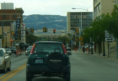 When Emma is kidnapped, the outlaws head north. At first the terrain is gentle with a few bumpy spots like this: 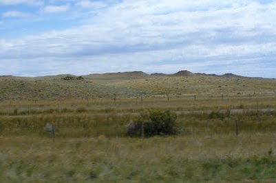 After riding a couple hours, the outlaws take the covering off Emma. She looks back at Casper and sees the Laramie Mtns in the distance.  The ground isn't too rough at this point although it takes time to ride around the small hills and piles of rocks.
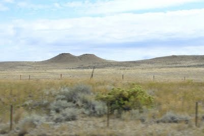 The first chance Emma has to remember a landmark is the sight below. It's called Teapot Rock and although it's stood since before Emma's time, erosion has taken it's toll. 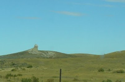 This is what it looks like today, but back in Emma's time, it had the shape of an actual teapot. 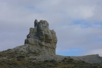 Emma's outlaws are going to ride between Teapot Rock and this huge land formation you see in the background. If you look close, you'll see some dark caves close to each side of the photo. Emma's outlaws will make camp near the one on the right that first night. 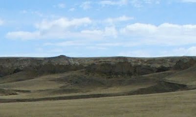 The next day, they'll keep the land mass on their right and head northeast around it. The farther they go, the more uneven the ground becomes. 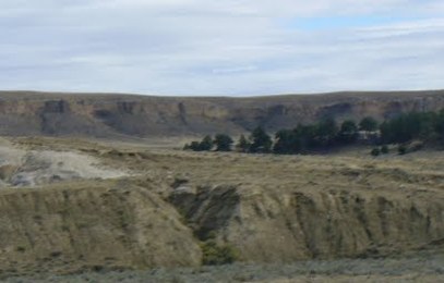 The 2nd day is slower going because they're either going down into coulees and draws or riding around them. 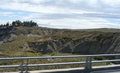 This is where they'll make camp the 2nd night because there's plenty of fresh grass: 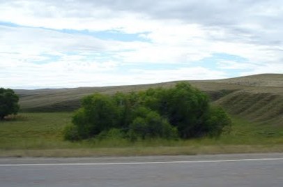 Now here's where one of the surprises came in... On the map and on
Google Earth, it said there were 2 buttes named Castle Rock. Well, here's the eastern half of Castle Rock in real life measuring 750 ft across: 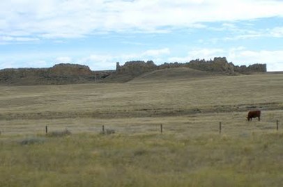 And here's the western one measuring 400 ft across the front (north side). Can you believe it? I did a double take when I first saw them sitting there. 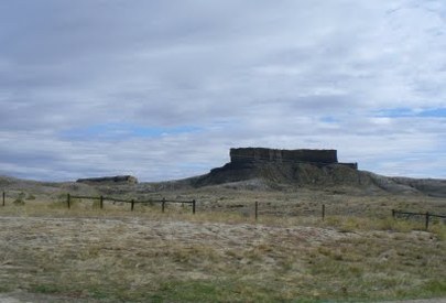 As the riders top a rise, they see the Pumpkin Buttes to the north. Now these were a complete surprise to me as well because I thought them to be just flat topped hills. Well, they are, but they're about 20 times wider than they are tall. I didn't envision this by looking at Google Earth. It took me awhile to find them on GE as well because the highway map calls them the 'Pumpkin' Buttes but GE calls them by their geographical location. There are actually about 6 of them but these 3 are the biggest. These measurements are approx. From left to right, they are: - North Middle Butte (1260 ft X 3000 ft) - South Middle Butte (2000 ft x 1680 ft) - South Butte (1890 ft x 1650 ft) 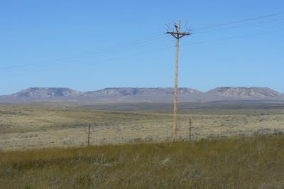 Emma ingrains these spectacular landmarks into her brain in case
the chance arises to escape. And no, I'm not going to tell you any more of the story. This recon proved 2 things: - First, the need to do a recon if you're going to refer to actual places. - And second, the wonderful resource of Google Earth because that's where I saw the first spectacular land mass and Teapot Rock which helped me choose this area in the first place. |
Posts About
Emma's Outlaw Connect with Anita Mae        |